Trails In Beloit
Beloit is widely known for its cool downtown, Farmers’ Market, and fabulous dining. However, Beloit is also a great place to enjoy nature. There are many trails in Beloit to hike and bike, as well as paddle. Take a look below for some of the best places to get away from it all!
Beckman Mill Park
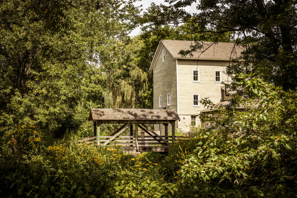
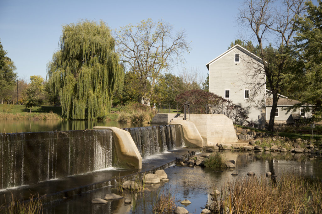
Beckman Mill is located at Beckman Mill County Park, 6 miles west of Beloit, Wisconsin. On the grounds of the 50-acre county park you will see an authentically restored 1868 grist mill, a dam, mill pond, fish ladder, foot bridge, saw mill display, 1840s cooperage, visitor center, gift shop, creamery, blacksmith shop, picnic shelter, vintage garden, nature trail and more.
Click here for a satellite view map.
Click here for a regular map.
Rock River Trail
Trails in Beloit are easy to find, as it sits on the midway point of the Rock River Trail which is a 320-mile course spanning Wisconsin and Illinois!
The Rock River Trail is a multi-use trail that was established in 2010 to promote recreational use and areas of scenic and historic interest and significance. There are several ways to enjoy the trail including:
You can also taste the trail on the Chocolate Trail, appreciate art on the Art Route, and discover history on the History Trail.
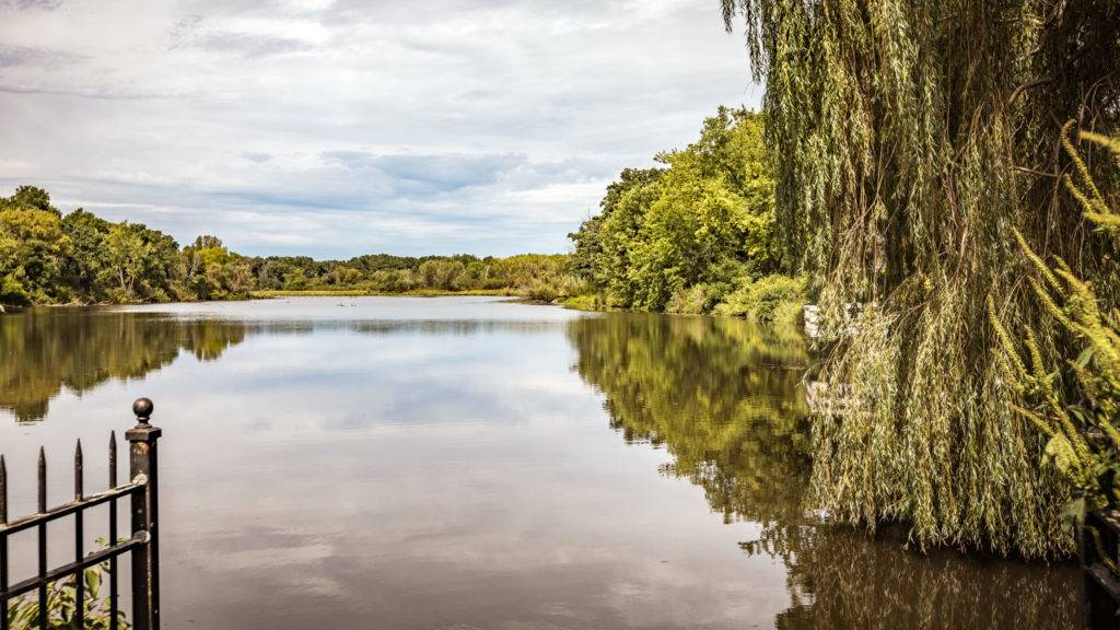
Nature at the Confluence
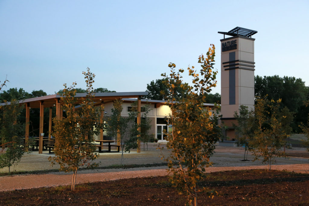
Nature at the Confluence is an outdoor urban ecology center located on property surrounded by the Rock River, Turtle Creek, and Kelly Creek. There are trails for hiking and a spot to launch kayaks. In winter, they offer candle-lit hikes and snow shoe instruction events.
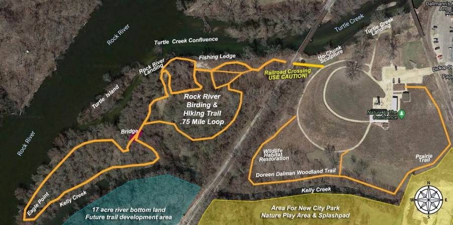
Click here to download PDF of 2020 Trail Map OR Click here to view online Google map.
Trails in Beloit Managed by the City
Click here to download Beloit Trails Guide & Map
Riverside Corridor Bike/Walking Trail

Location: Riverside Park, 1160 Riverside Dr.
Length: Approximately 9 mile loop
Features: This is one of the most popular places in Beloit to enjoy a run, a bike ride or a leisurely stroll along our beautiful riverfront. This paved trail winds along both sides of the Rock River and offers a variety of stops and lengths to enjoy. A recent shoreline restoration on the east side of the river included prairie plantings that are flourishing. Quite a bit of public art can be found along the trail. Restrooms are available in Riverside Park.
Trail Heads/Parking
• Rotary River Center (1160 Riverside Dr.)
• Mid-Lawn Parking Lot (across from ABC Supply Headquarters on the north side of the tennis courts)
• North Parking Lot (across from the Eclipse Center on Riverside Dr.)
• US Pride Park (1765 Shore Drive)
• Ironworks South Parking Lot (Third St. and W. Grand Ave.)
• Along Water Street
• Turtle Park (1312 E. Grand Ave.)
Stateline Prairie Restoration Park Nature Trail
Location: 400 Colby St.
Length: Under 1 mile loop
Features: This is a small park in an urban setting. Recently reclaimed and planted, it is now flourishing with prairie plants. Turtle Creek runs along one edge of the park. Crushed gravel trail. No restrooms.
Harper’s Prairie Nature Trail
Location: 2201 Whipple St. (Parking also available along Frederick St.)
Length: .63 mile loop
Features: This small park offers a mowed walking trail around a pond. Prairie plants and water plants are abundant. No restrooms.
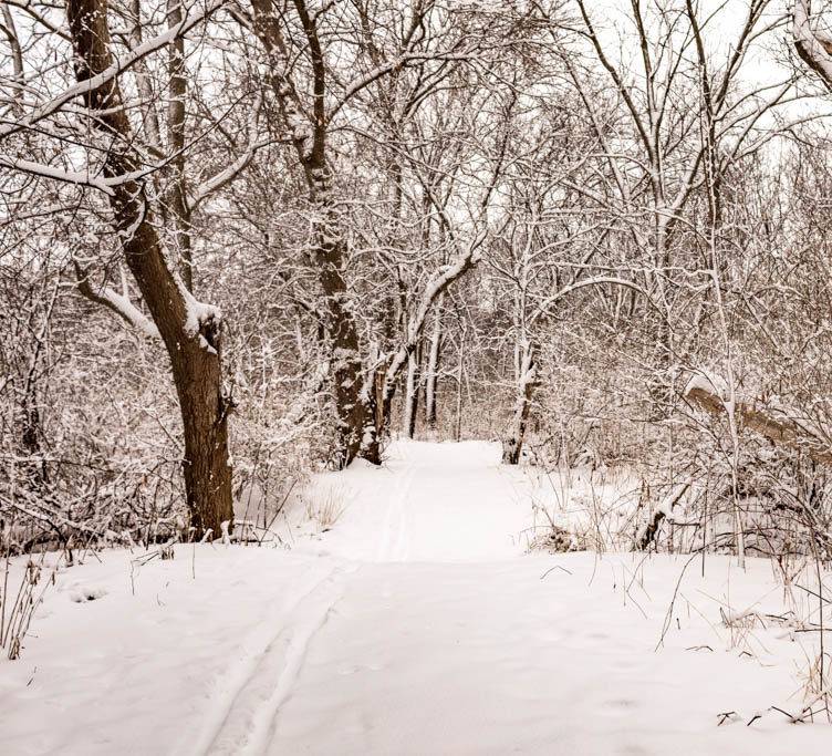
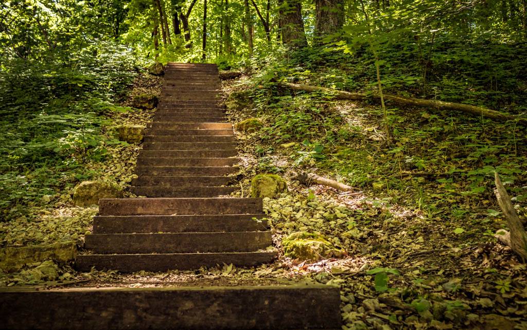
Turtle Creek Greenway Nature & Ski Trails
These trails offer you a way to get into nature right in the city! The mowed trails wind through woods following the contours of Turtle Creek. Wildlife sightings are frequent, including deer, fox, and hawks. There are varying options of trail length, with different loops available at different access points. Cross Country Ski Trails are groomed in the winter. No restrooms available.
Deerfield Estates Trail – Length: 2.63 miles – (Canterbury Dr., Deerfield and Sarah Ln., Creek Rd. and W. Hart Rd.)
Chatsworth Trail – Length: .91 mile – (Crittenden and Austin Pl., Chatsworth and E. Collingswood)
Moccasin Trail – Length: 1.29 miles– (Moccasin Trail and Bootmaker)
Milwaukee Road Trail – Length: 2.6 miles – (Across from 1930 Milwaukee Rd.)
Big Hill Regional Park Nature, Bike, Bird, and Ski Trails
Location: 1101 Big Hill Rd.
Trail Length: Unpaved trails (both gravel and mowed dirt) over 5 miles; Paved bike path.
Features: Big Hill Park is one of Beloit’s most scenic sites. Located on the bluffs of the Rock River, this 190-acre park boasts nature and hiking trails, an environmental education center, bike trail, cross-country ski trail, and a scenic overlook with spectacular vistas.
Big Hill Park was built as a memorial park for people who gave their life in World War I. Much of the construction took place in the early 1930’s by the Wisconsin Civilian Conservation Corps. A famous 90 ft. bluff on the West bank of the Rock River had been used to hold annual ski jumping competitions by the Beloit Ski Club. When warm winter spells hit, snow was imported in railroad gondolas that were unloaded at the base of the slope. Even though the ski jump is no longer in existence, the spectacular view remains from the top of the bluff and you can now enjoy the view from the scenic overlook.
Big Hill Park is listed on the Great Wisconsin Birding and Nature Trail. During the spring, the Rock River serves as a migratory route for hawks, passerines and waterfowl of all types making a trip to this park worthwhile.
Beloit Water Trails in Beloit
Turtle Creek & Rock River
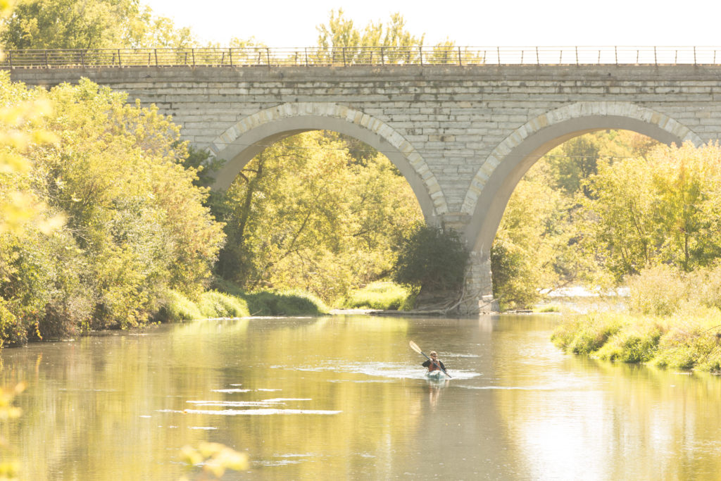
Turtle Creek is a beautiful waterway lined with woods that winds its way through seven miles of Beloit. It’s a fun creek to kayak, canoe or tube on. Launch kayaks just north of Beloit at Tiffany Bridge, the state’s oldest stone, five-arched bridge! Turtle Creek offers plenty of opportunities to see wildlife and breathtaking scenery.
Navigation Help for Kayaking on Turtle Creek
- Click here to see a map of several spots to launch or take-out.
- Miles Paddled documents canoe and kayak trips on rivers and creeks throughout Wisconsin including the Rock River and Turtle Creek.
- If you don’t own your own kayak, or you would prefer a guided trip, check out Rocktown Adventures.
- Check Turtle Creek’s cubic feet per second (cfs) flow at Carver Rock Road in Clinton here.
- Friends of Turtle Creek )is an informal group of people that are interested in protecting, enhancing and preserving Turtle Creek) Website
You can also kayak on the Rock River. Due to a large dam in Beloit, you have two paddling options available on the Rock River: launch north of Beloit and paddle down to take out before the dam, or launch at the John Rose Kayak and Canoe Launch and head downriver into Illinois.
Click here for Beloit Water Trails Map
Other Hike, Bike, and Water Trail
Resources
Rock River Coalition
Bike Routes
City of Beloit’s Website
List of Parks
List of Nature Centers and Reserves
SNOWMOBILE Trails in Beloit Area
Click here for information about Rock County snowmobile trails.
Click here for the Rock County Snowblowers, a nonprofit snowmobile club that meets once a month to provide nice groomed trails for the public.